Insider's Guide:
Our Favourite Things
to Do in Iceland
 Every time I go back in search of more things to do in Iceland, I feel like there’s something magical simmering just below the surface.
From the rich culture of the capital Reykjavík to the stunning landscapes of the countryside, one gets the sense that the number of mystical and unforgettable experiences here is almost unlimited—an impressive feat for such a tiny island!
Below, I’ve rounded up a few of my favourite Icelandic experiences.
My Favourite Things to Do in Iceland
Þingvellir
Stand on “the edge of America”
Iceland lies on the Mid-Atlantic Ridge, the mainly underwater border where the tectonic plates of America and Eurasia are slowly spreading apart.
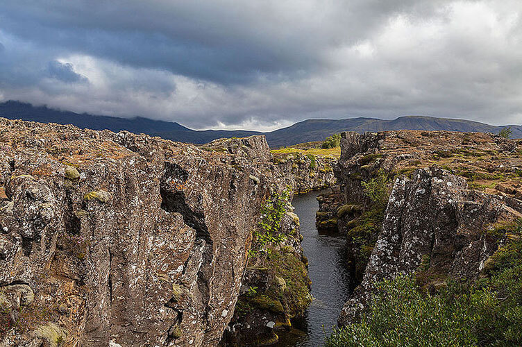
A huge rift runs through the country from southwest to northeast, disappearing and surfacing by turns, where the plates are heading in different directions. So although Iceland is politically and culturally part of Europe, half of it lies on the American plate and is moving westwards at an estimated rate of one to two centimetres (0.3 to 0.7 inches) a year.
At the ancient parliamentary site of Þingvellir, which lies on this rift, you can stand on the edge of America (geologically speaking) and see all the way to Europe, 10 kilometres (6 miles) away.
Reykjavík
Reykjavík is the most northerly capital in the world and the largest city in Iceland.
Situated on Faxa Bay on the southwest coast, the name roughly translates to “bay of smoke,” in reference to the steam emanating from the area’s hot springs.
It was here that Iceland’s first settler, Ingólfur Arnarson, landed in 874. According to the Sagas, when he approached the shore, he threw two carved, wooden pillars into the water and swore that he would settle where they washed ashore.
The settlement began as a small fishing village; a charter was granted in 1786 and the city became an episcopal see (official seat of a bishop) in 1796. Reykjavík has been the seat of the Althing since 1843, and it was made the capital of Iceland in 1918.
Despite the meaning behind the city’s name, Reykjavík is in fact one of world’s most smoke-free cities, due to its extensive use of clean, geothermal power.
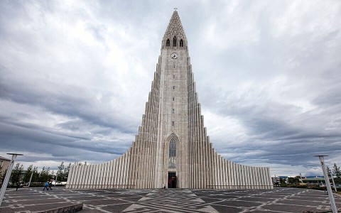
More than half of Iceland’s population lives in or near Reykjavík, making it the heart of the country’s cultural, commercial and governmental life. It’s a modern city, but the old centre—including the Parliament House (1881) and the mid-18th c. Government Building—has been carefully preserved.
Close to these are the National Library, the National Theatre and the statue of Ingólfur Arnarson. Interesting churches in Reykjavík include the old cathedral near the Parliament, and the new 75-metre-high (246-foot) Hallgríms-kirkja (with a great view over the city from the spire).
Other places worth visiting are the University (1911), the National Museum (1863)—which houses exhibits from around the world, items from the Viking age and Iceland’s nautical past—and Culture House Institute, where the priceless Saga manuscripts are on display.
See For Yourself
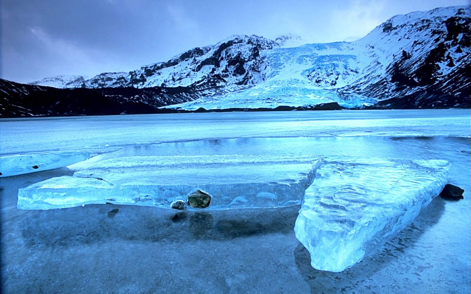
On our Iceland Winter Expedition, explore a land of untamed natural beauty and wild abandon, and find out firsthand why this tiny island near the arctic is one of the world’s hottest destinations.
DETAILED ITINERARYVolcanoes
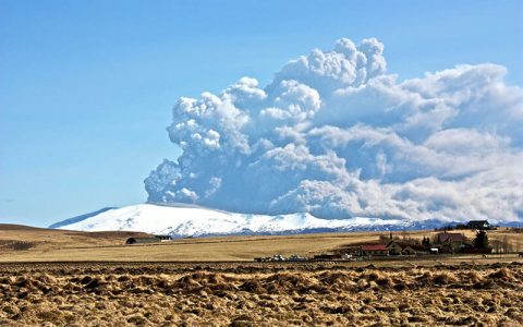
Iceland is one of the most active volcanic countries in the world.
There are about 200 post-glacial volcanoes, at least 30 of which have erupted since the country was settled in the 9th century.
Nearly every type of volcanic activity is represented in Iceland, the most common being fissure eruptions. One of these occurred in 1783, when the Lakagígar, with about 100 separate craters, erupted to create the largest lava flow ever recorded (covering 565 km² (351 mi.²).
The gases and ash from this eruption poisoned the grasslands, wreaking tremendous havoc on the countryside. The resulting damage to the farmland brought widespread famine to Iceland, resulting in the starvation deaths of almost ten thousand people.
Shield volcanoes of the Hawaiian type, like Skjaldbreiður near Þingvellir, are also numerous, but the only one active in historical times was the new Surtsey volcano.
Almost all the cone volcanoes of the Fuji type are ice-covered, the largest of them being Öræfajökull (2,119 m/6,952 ft.), Eyjafjallajökull (1,666 m/5,465 ft.), and Snæfellsjökull (1,446 m/4,809 ft.). Craters created by volcanic explosions are also quite common.
Mount Hekla
Hekla is the third most-active volcano in Iceland after Grímsvötn and Katla (the volcanoes under the enormous Vatnajökull and Myrdálsjökull glaciers).
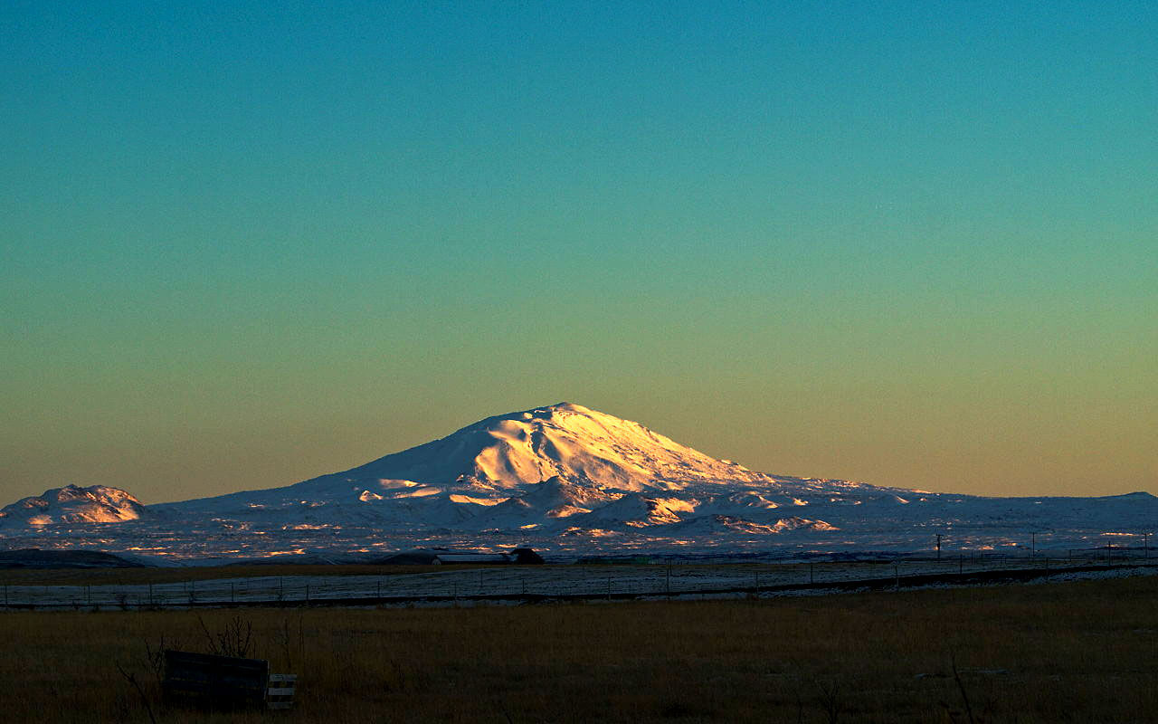
It has erupted 18 times in recorded history, and it is the only ridge-shaped stratovolcano in Iceland where eruptions occur along the same fissure.
The volcano is also unique in the composition of its magma: while most volcanoes in Iceland produce basalt, Hekla spews magma with a higher than usual silica content.
High-silica magma that cools at the surface produces a fine-grained rock called rhyolite, rather than low-silica magmas that produce fine-grained basalt.
This accounts for the unusually colourful landscape in the rocks of the Hekla highlands and in Landmannalaugar.
Among the numerous eruptions since the end of the last Ice Age, some have blanketed all of Iceland in a pale pumice stone (the last of these eruptions having happened about 900 BC).
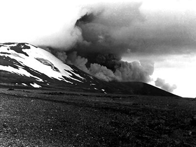
The first eruption in historical times was the devastating eruption of 1104, which covered half of Iceland in pumice rock, either killing or forcing a number of inhabitants to flee as the eruption covered farms in the area.
A common Hekla eruption begins with an enormous explosive event, followed by the opening of a fissure and a very spectacular curtain of fire as magma is boiled and extruded. The fissure phase can last days, after which the activity is confined to a single vent spewing torrents of lava.
The amount of lava produced since historical times out of Hekla alone is enough to build a one-metre wide, 1.6-metre-tall wall around the whole coast of Iceland.
Technically, Hekla erupts about once a century, but the frequent eruptions in the 20th century—in 1947, 1970, 1980, and 1991—have led most Icelanders to tell you that Hekla erupts every 10 years.
It last erupted on February 26, 2000; farmers in the area will tell you that the groundwater is drying up, a sure sign that Hekla is due to erupt again soon.
Thórsmörk (Þórsmörk)
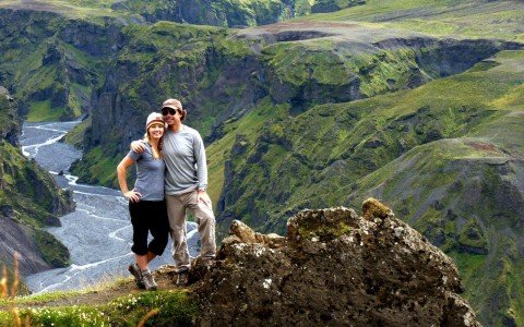
 Thórsmörk, or Þórsmörk (“Thór’s forest”), is named after the Norse god Þórr (Thor), the god of thunder and probably the dearest of the Norse pagan gods to Icelanders.
It is known as one of the most beautiful and lush places in Iceland, with the combined action of rivers, glaciers, winds and volcanic activity sculpting the rock into mountains and canyons covered with birches, willows and wildflowers.
The land and has been classified as a nature reserve since 1920. Thórsmörk is as forested a place as you’ll ever find in Iceland; its downy birch trees can grow as tall as nine metres (30 feet) tall.
Still, locals joke that if you get lost in the Icelandic forest, just stand up and you’ll find your way out!
Thórsmörk is squeezed between the rivers Krossá and Markar, and framed to the north, east and south by the neighbouring glaciers Tindfjallajökull, Mýrdalsjökull and Eyjafjallajökull.
Landmannalaugar
Hiking Nirvana
Thanks to the artistic creativity of Mount Hekla, Landmannalaugar has become one of the most popular tourist attractions in Iceland. This area is trekking and hiking heaven!
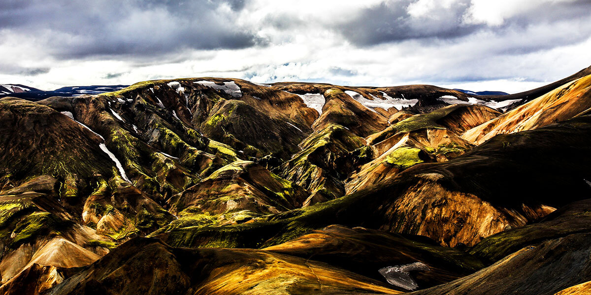
The landscape is truly exotic—a rugged and colourful land of huge geological variety that features warm springs, fumaroles and boiling mud pools.
Rhyolite is the predominant rock feature in the area—one of more than 700 types of igneous rock formed by cooled magma, it comes from relatively low-temperature magma that has erupted explosively and cooled rapidly.
Being made up of quartz and mica, it looks a little glassy and is not normally known for its vibrant hues; however, the Landmannalaugar’s geothermal chemistry has cooked the rocks into an infinite variety of subtle colours and variations, making it a visual feast for photographers.
The combination of scenic splendour and a true mountain wilderness environment has led to the formation of a number of mountain trails in the area, deservedly earning Landmannalaugar the title of best hiking area in the country.
MORE FROM Europe + Iceland
Reading for the Road: A Few of Our Favourite Books About Iceland
Iceland
Five hot destinations that are more accessible to Aussies
Iceland
Vestmannaeyjar: Iceland’s Westman Islands
Iceland
In Pictures: A Perfect Icelandic Itinerary
Iceland
Top New Tours for Family Travel
Iceland
Insider’s Guide: 7 Things To Do in Reykjavik
Iceland
Insider’s Guide: My 5 Favourite
Reykjavik Restaurants
Iceland
Insider’s Guide: Top 3 Reykjavik Hotels
Iceland
Icelanders: A Historic, Nordic Cool
Iceland
48 Hours in Iceland
Iceland
Hakarl and Brennivin: An Acquired Taste
Iceland